Shell Sectional Map No. 11- Pacific Northwest States, 1956
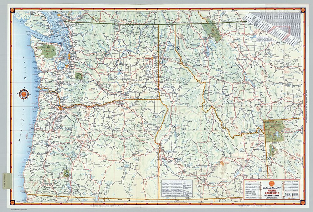
Shell Sectional Map No. 11- Pacific Northwest States, 1956 This atlas was originally bound for use by the staff of the San Francisco Examiner newspaper. It has been professionally unbound and boxed, preserving the original appearance and covers, which snap shut over the box portion. Each map was originally published as a separate roadmap distributed at Shell gas (filling) stations. Every map bears the Shell logo and a complete legend and sometimes the statement, "Current at date of publication, but subject to change." Copyright and lithography by H.M. Gousha Company, Chicago-San Jose. Map borders and covers (to the typical 23x10 cm folded edition) make liberal use of the distinctive Shell gold and red colors. The colorful maps in this atlas have often never been folded except as necessary for putting them into this atlas. All maps printed on both sides. Relief depicted by shading or hypsometric tints or sketches. Each map sheet may include such useful information as mileage charts (distances between cities), speed limits, a national highway map, highway safety pointers, state traffic rules, reminders for travelers, a list of available Shell maps, legend, and National Park fees and season. Regional and national maps include mileages and driving times between destinations. State maps include a gazetteer with population and is keyed to map location. Maps generally drawn in a polyconic projection.