Township Map Of The State Of Iowa, Early 1855
As low as
$39.95
In stock
SKU
002-1739002
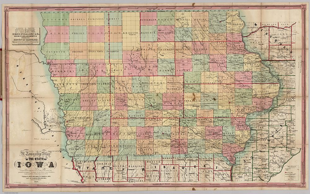
A Township Map Of The State Of Iowa. Compiled from the United States Surveys, official information and personal reconnaissance, showing the Streams, Roads, Towns, County Seats, Works of Internal Improvement, &c. &c. Published by Henn, Williams & Co. Fairfield, Iowa. and by R.L. Barnes, Philadelphia. No. 6 South 7th. Street 1855. Friend & Aub Lith. Phila. Entered ... 1854, by R.L Barnes ... Penna.
Early 1855, with the plate changed entirely from the 1851 issue. Shows "Great Western Mail & Emigrant Route to the Pacific" extending from Omaha. Full color. Folded into stamped red cloth covers 15x10 with "Henn, Williams & Co.'s Township Map Of Iowa" in gilt. Prime meridian is Washington D.C.
Write Your Own Review
A Township Map Of The State Of Iowa. Compiled from the United States Surveys, official information and personal reconnaissance, showing the Streams, Roads, Towns, County Seats, Works of Internal Improvement, &c. &c. Published by Henn, Williams & Co. Fairfield, Iowa. and by R.L. Barnes, Philadelphia. No. 6 South 7th. Street 1855. Friend & Aub Lith. Phila. Entered ... 1854, by R.L Barnes ... Penna. Early 1855, with the plate changed entirely from the 1851 issue. Shows "Great Western Mail & Emigrant Route to the Pacific" extending from Omaha. Full color. Folded into stamped red cloth covers 15x10 with "Henn, Williams & Co.'s Township Map Of Iowa" in gilt. Prime meridian is Washington D.C.