The Exposition City San Francisco, 1912
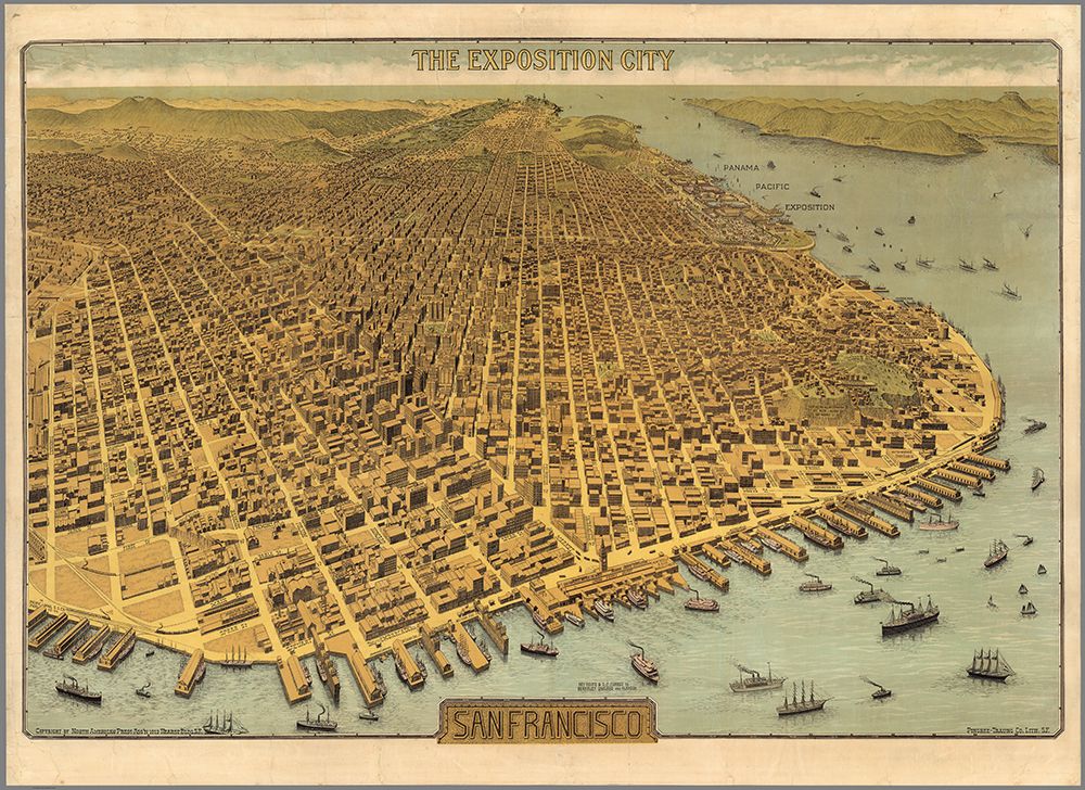
The Exposition City San Francisco. Copyright By North American Press Ass'n 1912 Hearst Bldg. S.F. Pingree-Traung Co. Lith. S.F. This map provides a detailed view of the extraordinary rebuilding of downtown San Francisco only six years after the devastating earthquake and fire of 1906. Just a few lots remain unbuilt. It is a scarce map that was issued in two forms: on thin paper as a folded map with the Supplement to the San Francisco Standard Guide, and on thicker paper unfolded (our copy, linen backed as a wall map). A reduced size reproduction of the copy at the San Francisco Society of California Pioneers Library was issued in 1968 (see our 10016.000). The Panama Pacific Exposition of 1915 is shown prospectively. A second issue of this larger map is at the Wells Fargo Museum in San Francisco - it adds a winding road going up Mount Tamalpais as well as names of buildings on the block bounded by First, Bryant, Brannon, and Beale streets.