The Coast of N.W. America, 1798
As low as
$39.95
In stock
SKU
002-3354005
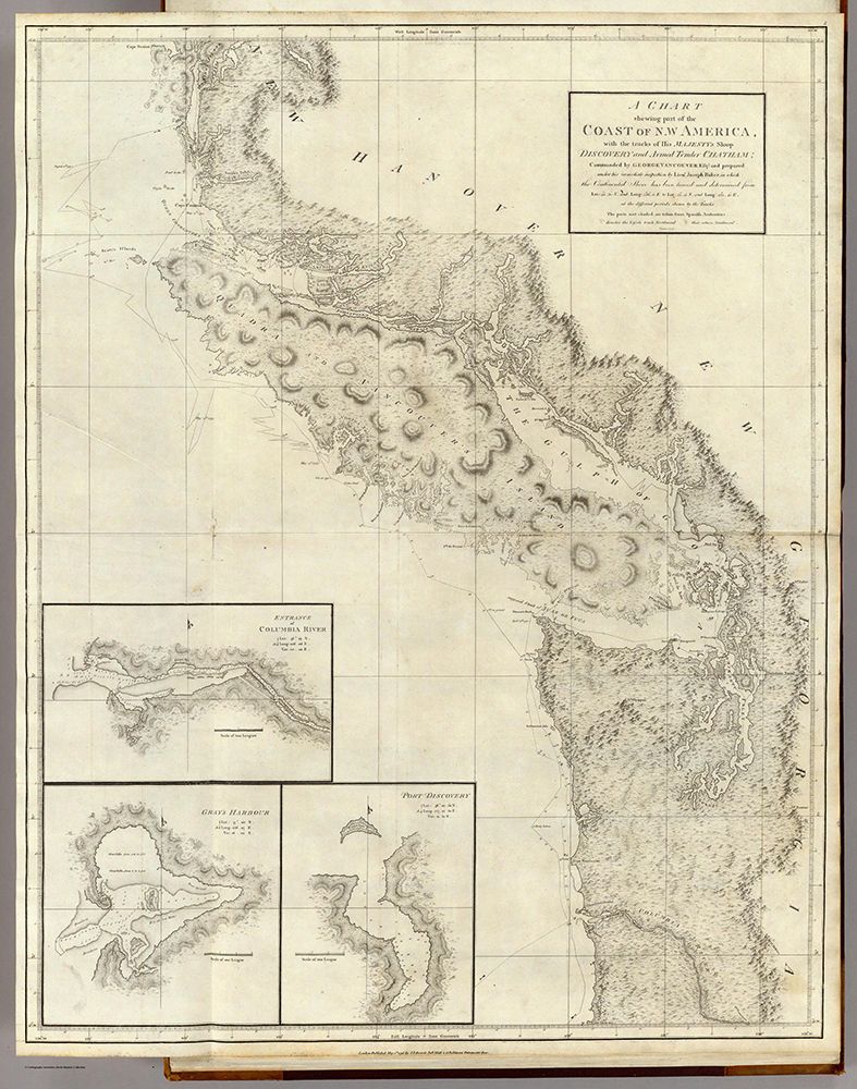
A Chart shewing part of the Coast of N.W. America, with the tracks of His Majesty's Sloop Discovery and Armed Tender Chatham; Commanded by George Vancouver Esqr. and prepared under his immediate inspection by Lieut. Joseph Baker, in which the Continental Shore has been traced and determined from Lat. 45¼30'N. and Long. 236¼12' E. to Lat. 52¼15'N and Long 232¼40'E. at the different periods shown by the Tracks. Warner Sculp. 5. (with) three inset maps. London: Published May 1st 1798, by J. Edwards Pall Mall & G. Robinson Paternoster Row.
Write Your Own Review
A Chart shewing part of the Coast of N.W. America, with the tracks of His Majesty's Sloop Discovery and Armed Tender Chatham; Commanded by George Vancouver Esqr. and prepared under his immediate inspection by Lieut. Joseph Baker, in which the Continental Shore has been traced and determined from Lat. 45¼30'N. and Long. 236¼12' E. to Lat. 52¼15'N and Long 232¼40'E. at the different periods shown by the Tracks. Warner Sculp. 5. (with) three inset maps. London: Published May 1st 1798, by J. Edwards Pall Mall & G. Robinson Paternoster Row.